
- A trough system is expected to generate showers and thunderstorm activity from tomorrow (Wednesday). Rainfall accumulations of 1 to 2 inches are possible from late Wednesday into Thursday.
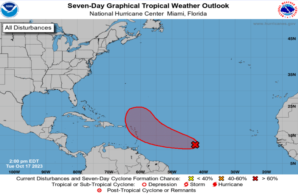
- Satellite imagery indicates that a broad area of low pressure located about 1100 miles east of the Windward Islands has become better defined since this morning, and the associated showers and thunderstorms are also showing signs of organization. Environmental conditions are expected to remain conducive for gradual development, and a tropical depression will likely form during the next day or two while the system moves westward to west-northwestward across the central and western tropical Atlantic.
- Popular modeling tools used to track systems are again in disagreement on the forecast track and intensity of this system. Current anomalies in environmental conditions is again resulting in high uncertainties in track and intensity forecasting.
- Due to the uncertainty of forecasting the level of intensification advisories could range from flood warnings to Tropical storm warnings during this period.
More definite information will be provided if / when it becomes available.
- Models however are indicating that by Friday 20th October from about midday showers associated with this system could begin affecting the region. Over parts of the region, rainfall projections vary from 2-4 inches over 24 to 48 hours (Friday to Sunday).
- Deterioration in sea conditions is expected to begin from Thursday night and will gradually get worse into the weekend with waves expected to peak near 3.5m/12ft as the system moves closer. A small craft warning and high surf advisory will be issued from Thursday19th October 2023. Small craft operators and sea bathers are advised to take all the necessary precautions to protect their lives and property ahead of and during deteriorating sea conditions.
- Residents are asked to closely monitor the progress of this system and to ensure that all preparedness plans are finalized and ready to be activated if needed, at short notice.
- The Meteorological service is committed to monitoring this system and will provide updates.